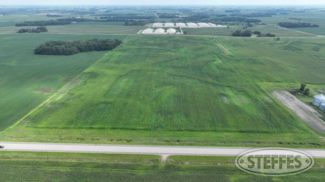
An exceptional opportunity to acquire 268.11± acres of prime farmland in Stockholm Township, Wright County, MN. This productive land will be offered in three tracts; surveys have been completed. The parcels have been organically certified since 2018. Don’t miss your chance to invest in quality farmland in a sought-after location.
Tract 1
Description: The Northeast Quarter of the Northeast Quarter of Section 23, Township 118, Range 28, Wright County, Minnesota. ALSO The West Half of the Northwest Quarter of Section 24, Township 118, Range 28, Wright County, Minnesota, excepting therefrom the East 249.59 feet of the West 299.59 feet of the South 521.86 feet of the Southwest Quarter of the Northwest Quarter of said Section 24.
Total Acres: 116.58± (See Survey, Parcel 1)
Cropland Acres: 113.61±
PID #: 218-000-242200 & 218-000-231100
Crop Productivity Index: 91.2
Soils: ReedslakeLe Sueur complex, 1 to 6 percent slopes (37.6%), CanisteoGlencoe complex, 0 to 2 percent slopes (25.2%), Cordova clay loam, 0 to 2 percent slopes (20.1%), Klossner muck, 0 to 1 percent slopes (8.9%), CokatoStorden complex, 6 to 12 percent slopes, eroded (6.0%), Hamel loam, 0 to 2 percent slopes (2.2%)2025 Taxes: $7,328.00
2 Building Entitlements
Tract 2
Description: Part of the Northwest Quarter of Section 26, Township 118, Range 28, Wright County, Minnesota described as follows: Beginning at the northwest corner of said Northwest Quarter; thence on an assumed bearing of South 00 degrees 00 minutes 00 seconds East along the West line of said Northwest Quarter 1075.00 feet; thence North 90 degrees 00 minutes 00 seconds East 600.00 feet; thence easterly 2068.20 feet to a point on the east line of said Northwest Quarter distant 1075.00 feet southerly of the northeast corner of said Northwest Quarter, as measured along said east line; thence northerly along said East line 1075.00 feet to the North line of said Northwest Quarter; thence westerly along said North line 2689.21 feet to the point of beginning.
Total Acres: 65.54± (See Survey, Parcel 2)
Cropland Acres: 65.26±
PID #: 218-000-262300 (That part of, new legal & PID# to be assigned) & 218-000-262100 (That part of, new legal & PID# to be assigned)
Crop Productivity Index: 95
Soils: ReedslakeLe Sueur complex, 1 to 6 percent slopes (49.1%), CanisteoGlencoe complex, 0 to 2 percent slopes (31.9%), Le Sueur loam, 1 to 3 percent slopes (13.5%), Cordova clay loam, 0 to 2 percent slopes (4.2%), CokatoStorden complex, 6 to 12 percent slopes, eroded (0.8%), Glencoe clay loam, 0 to 1 percent slopes (0.5%)
2025 Taxes: $6,620.00 (For entire land. New tax amount TBD)
1 Building Entitlement
Highway Right of Way Easement
Drainage Easement
Tract 3
Description: Part of the Northwest Quarter of Section 26, Township 118, Range 28, Wright County, Minnesota described as follows: Commencing at the northwest corner of said Northwest Quarter; thence on an assumed bearing of South 00 degrees 00 minutes 00 seconds East along the west line of said Northwest Quarter 1075.00 feet; thence North 90 degrees 00 minutes 00 seconds East 600.00 feet to the point of beginning of the parcel to be described; thence South 00 degrees 00 minutes 00 seconds East 660.00 feet; thence South 90 degrees 00 minutes 00 seconds West 600.00 feet to said West line of said Northwest Quarter; thence South 00 degrees 00 minutes 00 seconds East along said West line 904.54 feet to the South line of said Northwest Quarter; thence easterly along said South line 2636.75 feet to the East line of said Northwest Quarter; thence northerly along said East line 1562.71 feet, more or less, to a point on said east line distant 1075.00 feet southerly of the northeast corner of said Northwest Quarter, as measured along said east line; thence westerly 2068.20 feet to the point of beginning.
Total Acres: 86.64± (See Survey, Parcel 3)
Cropland Acres: 84.75±
PID #: 218-000-262300 (part), 218-000-262100 (part), & 218-000-263200
Crop Productivity Index: 89.2
Soils: CanisteoGlencoe complex, 0 to 2 percent slopes (29.4%), AngusLe Sueur complex, 1 to 6 percent slopes (18.4%), CokatoStorden complex, 6 to 12 percent slopes, eroded (18.3%), Cordova clay loam, 0 to 2 percent slopes (11.1%), ReedslakeÂLe Sueur complex, 1 to 6 percent slopes (10.1%), Klossner muck, 0 to 1 percent slopes (5.8%), LesterStorden complex, 6 to 10 percent slopes, moderately eroded (4.3%), Lester loam, 6 to 10 percent slopes, moderately eroded (1.3%), Hamel loam, 0 to 2 percent slopes (1.2%), Angus loam, 2 to 6 percent slopes (0.1%)
2025 Taxes: $7,574.00
2 Building Entitlements
Highway Right of Way Easement
Drainage Easement
TERMS: Ten percent down upon signing purchase agreement, payable by cash or check. Balance due at closing within 30 days. This is a 5% buyer’s premium auction.