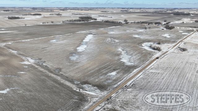
We are pleased to offer 312± acres in Big Stone County at public auction, being sold in three individual parcels. This property presents a desirable mix of productive farmland and quality recreational land, creating opportunities for farmers, investors, and outdoor enthusiasts alike. Tract 1 is primarily a hunting and recreational parcel featuring natural cover and wildlife habitat, along with 12± acres of farmland that is currently rented for the 2026 crop season. Tracts 2 and 3 consist of productive tillable farmland, both of which are also rented for the 2026 crop season. Together, these parcels offer flexibility for buyers seeking diversified, mixed-use land ownership. The property will be offered at auction, providing bidders the opportunity to purchase individual tracts or multiple parcels.
Big Stone County, MN – Prior Township
Description: The South Half of the Southeast Quarter (S½SE¼), Section Two (2), Township One Hundred Twenty-two (122) North, Range Forty-seven (47) West of the 5th P.M., Big Stone County, Minnesota & The Southwest Quarter (SW¼) of Section Four (4), Township One Hundred Twenty-two (122) North, Range Forty-seven (47) West of the 5th P.M., Big Stone County, Minnesota & Government Lots Three (3) and Four (4), Section Nine (9), Township One Hundred Twentytwo (122) North, Range Forty-seven (47) West of the 5th P.M., lying North and East of Trunk Highway No. 7 (formerly No. 103) as now used and located, Big Stone County, Minnesota Parcel Number: 13-0216-000
Total Acres: 312.16±
PID #: PID # 13-0211-000, 13-0216-000, & 13-0191-000
To Be Sold in 3 Tracts!
Tract 1:
Description: That part of the Southwest Quarter (SW1/4) of Section 4, Township 122 North, Range 47 West, Big Stone County, Minnesota, and that part of Government Lot 4 of Section 9, Township 122 North, Range 47 West, Big Stone County, Minnesota lying northerly of the northerly right of way line of Minnesota Trunk Highway No. 7 and lying westerly of the following described line: Commencing at the West Quarter corner of said Section 4; thence on an assumed bearing of South 89 degrees 24 minutes 23 seconds East along the north line of said SW1/4, a distance of 1006.51 feet to the point of beginning of the line herein described; thence South 06 degrees 12 minutes 26 seconds West, a distance of 351.84 feet; thence South 00 degrees 02 minutes 01 seconds East, a distance of 671.69 feet; thence South 01 degrees 14 minutes 42 seconds East, a distance of 1030.86 feet; thence South 18 degrees 30 minutes 26 seconds East, a distance of 576.17 feet; thence South 02 degrees 24 minutes 50 seconds East, a distance of 581.67 feet; thence South 02 degrees 17 minutes 44 seconds East, a distance of 696.04 feet to the northerly right of way line of said Minnesota Trunk Highway No. 7 and said line terminating thereat.
Total Acres: 82.93± (See survey, Lot C)
Cropland Acres: 15.36±
PID #: 13-0211-000 (That part of, new legal & PID# to be assigned) & 13-0216-000 (That part of, new legal & PID# to be assigned)
Crop Productivity Index: 85.1
Soils: AazdahlLakepark complex, 0 to 4 percent slopes (26.3%), AazdahlFormdaleBalaton clay loams, 0 to 4 percent slopes (21.8%), AazdahlQuamLakepark complex, 0 to 4 percent slopes (21.6%), EsmondHeimdalSisseton complex, 2 to 6 percent slopes (18.9%), LangheiBarnesDarnen complex, 5 to 30 percent slopes (11.4%)
Taxes (2025): $4,658.00 (For entire land. New tax amount TBD)
NO US Fish & Wildlife Easement
Buyer receives $1,548.54 in rent on 12.29 acres for 2026 crop season & buyer pays full 2026 taxes.
One portable deer stand will be removed from the property and is not included in real estate.
There are other permanent deer stands that will be included with the real estate.
Tract 2:
Description: That part of the Southwest Quarter (SW1/4) of Section 4, Township 122 North, Range 47 West, Big Stone County, Minnesota, and that part of Government Lot 3 and that part of Government Lot 4 of Section 9, Township 122 North, Range 47 West, Big Stone County, Minnesota lying northerly of the northerly right of way line of Minnesota Trunk Highway No. 7 and lying easterly of the following described line: Commencing at the West Quarter corner of said Section 4; thence on an assumed bearing of South 89 degrees 24 minutes 23 seconds East along the north line of said SW1/4, a distance of 1006.51 feet to the point of beginning of the line herein described; thence South 06 degrees 12 minutes 26 seconds West, a distance of 351.84 feet; thence South 00 degrees 02 minutes 01 seconds East, a distance of 671.69 feet; thence South 01 degrees 14 minutes 42 seconds East, a distance of 1030.86 feet; thence South 18 degrees 30 minutes 26 seconds East, a distance of 576.17 feet; thence South 02 degrees 24 minutes 50 seconds East, a distance of 581.67 feet; thence South 02 degrees 17 minutes 44 seconds East, a distance of 696.04 feet to the northerly right of way line of said Minnesota Trunk Highway No. 7 and said line terminating thereat.
Total Acres: 147.61± Acres (See survey, Lot D)
Cropland Acres: 127.13±
PID #: 13-0211-000 (That part of, new legal & PID# to be assigned) & 13-0216-000 (That part of, new legal & PID# to be assigned)
Crop Productivity Index: 87.8
Soils: Fram loam, 1 to 4 percent slopes (21.8%), EsmondHeimdalSisseton complex, 2 to 6 percent slopes (20.0%), AazdahlBalatonFlom complex, 0 to 3 percent slopes (16.4%), EsmondSissetonHeimdal, complex, 2 to 12 percent slopes, moderately eroded (14.8%), FlomAazdahlQuam complex, 0 to 4 percent slopes (13.5%), AazdahlQuamLakepark complex, 0 to 4 percent slopes (4.9%), AazdahlFormdaleBalaton clay loams, 0 to 4 percent slopes (4.2%), AazdahlLakepark complex, 0 to 4 percent slopes (4.2%), Esmond loam, 18 to 45 percent slopes, bouldery (0.2%)
Taxes (2025): $4,658.00 (For entire land. New tax amount TBD)
NO US Fish & Wildlife Easement
Buyer receives $19,832.28 in rent on 127.13 acres for 2026 crop season & buyer pays full 2026 taxes.
Tract 3:
Description: The South Half of the Southeast Quarter (S½SE¼), Section Two (2), Township One Hundred Twenty-two (122) North, Range Forty-seven (47) West of the 5th P.M., Big Stone County, Minnesota
Total Acres: 80±
Cropland Acres: 73.86±
PID #: 13-0191-000
Crop Productivity Index: 80.9
Soils: EsmondSissetonHeimdal, complex, 2 to 12 percent slopes, moderately eroded (52.5%), Lindaas silty clay loam (30.6%), Fram loam, 1 to 4 percent slopes (11.5%), Gonvick loam, 1 to 4 percent slopes (2.7%), Svea loam, 1 to 3 percent slopes (2.5%), Bigstone silty clay loam, ponded (0.2%)
Taxes (2025): $2,338.00
NO US Fish & Wildlife Easement
Buyer receives $11,253.00 in rent on 72.6 acres for 2026 crop season & buyer pays full 2026 taxes.
TERMS: Ten percent down upon signing purchase agreement, payable by cash or check. Balance due at closing within 30 days. This is a 5% buyer’s premium auction.