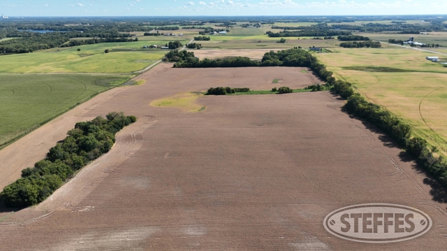
WRIGHT COUNTY, MN - CORINNA TOWNSHIP
Total Acres: 242.33±
PID #: 206-000-144100, 206-000-144200, 206-000-142100, & 206-000-151100
To Be Sold in 5 Tracts!
TRACT 1
Description: The West Half of the Southeast Quarter (W1/2 of the SE1/4) and the West Half of the East Half of the Southeast Quarter (W1/2 of the E1/2 of the SE1/4), all being in Section 14, Township 121 North, Range 27 West, Wright County, Minnesota. EXCEPT The West 946.95 feel of the North 460.00 feet of the Southeast Quarter (SE1/4) of Section 14, Township 121 North, Range 27 West, Wright County, Minnesota. ALSO EXCEPT The South 375.00 feet of the West 1120.00 feet of the Southeast Quarter (SE1/4) of Section 14, Township 121 North, Range 27 West, Wright County, Minnesota.
Total Acres: 104.5± (See Survey, Tract D)
Cropland Acres: Approximately 97.08±
PID #: 206-000-144200 (That part of, new legal & PID# to be assigned) & 206-000-144100
Soil Productivity Index: 90.8
Soils: AngusLe Sueur complex, 1 to 6 percent slopes (44.1%), Angus loam, 2 to 6 percent slopes (25.2%), Cordova clay loam, 0 to 2 percent slopes (11.2%), AngusCordova complex, 0 to 5 percent slopes (7.2%), Glencoe clay loam, 0 to 1 percent slopes (5.8%), Lester loam, 6 to 10 percent slopes, moderately eroded (3.8%), Lester loam, 10 to 16 percent slopes, moderately eroded (1.5%), Le Sueur loam, 1 to 3 percent slopes (1.2%)
Taxes (2024): $3,604.00 (For entire land. New tax amount TBD)
1 Building Entitlement
TRACT 2
Description: The North Half of the Northwest Quarter (N1/2 of the NW1/4) of Section 14, Township 121 North, Range 27 West, Wright County, Minnesota. EXCEPT That part of the North Half of the Northwest Quarter (N1/2 of the NW1/4) of Section 14, Township 121 North, Range 27 West, Wright County, Minnesota, described as follows: Commencing at the North Quarter corner of said Section 14; thence on an assumed bearing of North 87 degrees 48 minutes 09 seconds West along the north line of said N1/ of the NW1/4, 574.01 feet to the point of beginning of the tract of land herein described; thence continue North 87 degrees 48 minutes 09 seconds West along last said line, 655.17 feet; thence South 01 degree 33 minutes 3 2 seconds West, 80 .76 feet; thence North 85 degrees 1 minutes 35 seconds East, 2 1.95 feet; thence North 00 degrees 13 minutes 18 seconds East, 407.51 feet; thence South 87 degrees 48 minutes 09 seconds East, 454.03 feet; thence 2 North 00 degrees 00 minutes 00 2seconds East, 369.29 feet to the 2 point of beginning and there terminating.
Total Acres: 79.68± (See Survey, Tract B)
Cropland Acres: Approximately 65.79±
PID #: 206-000-142100 (That part of, new legal & PID# to be assigned)
Soil Productivity Index: 89.7
Soils: AngusLe Sueur complex, 1 to 6 percent slopes (56.9%), Angus loam, 2 to 6 percent slopes (12.1%), Hamel loam, 0 to 2 percent slopes (10.3%), Cordova clay loam, 0 to 2 percent slopes (8.2%), DorsetAlmora complex, 1 to 4 percent slopes (6.7%), LesterMalardi complex, 6 to 12 percent slopes, eroded (2.4%), HamelGlencoe complex, 0 to 2 percent slopes (2.0%), DorsetTwo Inlets complex, 2 to 6 percent slopes (1.2%), Glencoe clay loam, 0 to 1 percent slopes (0.2%)
Taxes (2024): $2,566.00 (For entire land. New tax amount TBD)
1 Building Entitlement
TRACT 3:
Description: The Northeast Quarter of the Northeast Quarter (NE1/4 of NE1/4) of Section 15, Township 121 North, Range 27 West, Wright County, Minnesota.
Total Acres: 40.83± (See Survey, Tract A)
Cropland Acres: Approximately 26.2±
PID #: 206-000-151100
Soil Productivity Index: 51.8
Soils: DorsetTwo Inlets complex, 6 to 12 percent slopes (39.1%), DorsetTwo Inlets complex, 2 to 6 percent slopes (31.3%), LesterMalardi complex, 6 to 12 percent slopes, eroded (14.6%), Southhaven loam, 0 to 2 percent slopes (8.9%), DorsetTwo Inlets complex, 12 to 20 percent slopes (3.5%), DorsetTwo Inlets complex, 20 to 35 percent slopes (1.5%), Seelyeville and Markey soils, ponded, 0 to 1 percent slopes (0.6%), Almora loam, 0 to 2 percent slopes (0.5%)
Taxes (2024): $946.00
1 Building Entitlement
TRACT 4:
Description: That part of the North Half of the Northwest Quarter (N1/2 of the NW1/4) of Section 14, Township 121 North, Range 27 West, Wright County, Minnesota, described as follows: Commencing at the North Quarter corner of said Section 14; thence on an assumed bearing of North 87 degrees 48 minutes 09 seconds West along the north line of said N1/ of the NW1 /4, 57 4.01 feet to the point of beginning of the tract of land herein described; thence continue North 87 degrees 48 minutes 09 seconds West along last said line, 655.17 feel; thence South 01 degree 33 minutes 3 2 seconds West, 80 .76 feet; thence North 85 degrees 1 minutes 35 seconds East, 2 1.95 feet; thence North 00 degrees 13 minutes 18 seconds East, 407.51 feet; thence South 87 degrees 48 minutes 09 seconds East, 454.03 feet; thence 2 North 00 degrees 00 minutes 00 2seconds East, 369.29 feet to the 2 point of beginning and there terminating.
Total Acres: 7.68± (See Survey, Tract C)
Cropland Acres: Approximately 1.36±
PID #: 206-000-142100 (That part of, new legal & PID# to be assigned)
Soil Productivity Index: 94.3
Soils: AngusLe Sueur complex, 1 to 6 percent slopes (92.6%), Glencoe clay loam, 0 to 1 percent slopes (7.4%)
Taxes (2024): $2,566.00 (For entire land. New tax amount TBD)
1 Building Entitlement
TRACT 5:
Description: The South 375.00 feet of the West 1120.00 feet of the Southeast Quarter (SE1/4) of Section 14, Township 121 North, Range 27 West, Wright County, Minnesota.
Total Acres: 9.64± (See Survey, Tract E)
Cropland Acres: Approximately 3.31±
PID #: 206-000-144200 (That part of, new legal & PID# to be assigned)
Soil Productivity Index: 80.4
Soils: Lester loam, 6 to 10 percent slopes, moderately eroded (64.4%), Glencoe clay loam, 0 to 1 percent slopes (19.0%), Angus loam, 2 to 6 percent slopes (12.4%), AngusLe Sueur complex, 1 to 6 percent slopes (4.2%)
Taxes (2024): $2,174.00 (For entire land. New tax amount TBD)
1 Building Entitlement
TERMS: Ten percent down upon signing purchase agreement, payable by cash or check. Balance due at closing on or before January 8, 2025. This is a 5% buyer’s premium auction.
CONTACT
Eric Gabrielson at Steffes Group, (701) 238-2570 or (320) 693-9371
Steffes Group Inc., 23579 MN Hwy 22 South, Litchfield, MN 55355