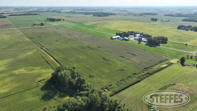
MCLEOD COUNTY, MN – HALE TOWNSHIP
Description: The East Half of the Northwest Quarter (E1/2 of the NW1/4) of Section 12, Township 117 North, Range 28 West, McLeod County, Minnesota. EXCEPT That part of the East Half of the Northwest Quarter (E1/2 of the NW1/4) of Section 12, Township 117 North, Range 28 West, McLeod County, Minnesota, described as follows: Beginning at the northwest corner of said E1/2 of the NW1/4; thence on an assumed bearing of South 00 degrees 04 minutes 27 seconds West along the west line of said E1/2 of the NW1/4, 1071.27 feet; thence North 90 degrees 00 minutes 00 seconds East, 500.00 feet; thence North 00 degrees 00 minutes 00 seconds East, 245.00 feet; thence North 10 degrees 36 minutes 14 seconds West, 850.25 feet to the north line of said E1/2 of the NW1/4; thence South 88 degrees 25 minutes 00 seconds West along last said line, 342.29 feet to the point of beginning and there terminating. Containing 68.92 Acres, more or less. Subject to easements of record. Subject to any and all enforceable restrictive covenants.
Total Acres: 68.92± (See survey)
Cropland Acres: Approximately 65.92±
PID #: 05.012.0500 (That part of, new legal & PID# to be assigned)
Crop Productivity Index: 82.6
Soils: LesterStorden complex (42.6%), Klossner muck (16.9%), Cordova clay loam (11.1%), Mayer loam (10.7%)
Taxes (2025): $5,202.00 (For entire land. New tax amount TBD)
NO US Fish & Wildlife Easement
TERMS: Ten percent down upon signing purchase agreement, payable by cash or check. Balance due at closing after January 1, 2026. This is a 5% buyer’s premium auction.