Nicollet County, MN – Nicollet Township
Description: E 1/2 SE 1/4 35-109-28ACRES 80.00 SW 1/4 OF SE 1/4 35-109-28ACRES 40.00 E 55 1/4AC OF S 1/2 SW 1/4 "EX 10AC" 35 109 28AC45.25 S 1/2 OF SEC 36 LYING WOF RAVINE CL 36-109-28ACRES 152.80 GL 1 1-108-28ACRES 28.70 GL2 LYING WOF RAVINE CL 1-108-28ACRES 13.35 GL 1 2-108-28 ACRES 45.20 GL 2 2-108-28 ACRES 27.63 GL 3 "EX 5.25 AC" 2-108-28 ACRES 31.15 TOTAL ACRES 464.08 & N 1/2 NE 1/4 LYG SOFCR 71 "EX 1.8 7 AC PCL2 ROW PLATS", "EX9.31AC ", "EX.36AC" & "EX 9.47 AC"= 11.64AC CR/15.39 AC PL; GL3= 30AC CR/ 25.4AC PL;GL4 "EX.69 AC", "EX9.64AC" & "EX.99 AC PCL2 ROWS", "EX ELY 785.62'+/·" = 16.28AC CR/ 25.68 PL;GL2 LYG EOF RAVINE CL&SOFCR 71 "EX PCL2 ROW PLAT8 ", "EX 11AC", "EX2.53AC" = 3.61AC ; TOTAL=61.53AC CR/70.08AC
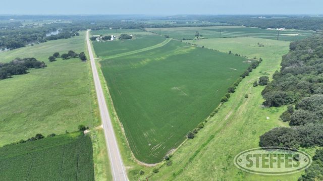
Total Acres: 525.63±
PID #: 09.036.0500 & 09.101.0200
To Be Sold in 7 Tracts!
TRACT 1:
- Description: That part of the South Half of the Southwest Quarter (S112 of the SW114) of Section 35, Township 109 North, Range 28 West, Nicollet County, Minnesota, lying easterly of the following described line: Commencing at the Southwest corner of said Section 35; thence on an assumed bearing of North 90 degrees 00 minutes 00 seconds East along the south line of said S112 of the SW1/4, 1362.52 feet to the point of beginning of the line herein described; thence North 08 degrees 00 minutes 00 seconds East, 360.79 feet; thence North 80 degrees 00 minutes 00 seconds West, 305.00 feet; thence North 02 degrees 11 minutes 26 seconds East, 276.69 feet; thence North 04 degrees 32 minutes 50 seconds East, 632 feet, more or less, to the north line of said S112 of the SW114 and said line terminating thereat.
- Total Acres: 43.47± (See survey, Tract 1)
- Cropland Acres: 31.93±
- PID #: 09.036.0500 (That part of, new legal & PID# to be assigned)
- Crop Productivity Index: 40.5
- Soils: Tilfer silty clay loam (52.6%), Copaston loam (27.0%), Joliet silty clay loam (20.4%)
- Taxes (2025): $6,552.00 (For entire land. New tax amount TBD)
- NO US Fish & Wildlife Easement
TRACT 2:
- Description: See survey
- Total Acres: 160.59± (See survey, Tract 2)
- Cropland Acres: 25.84±
- PID #: 09.036.0500 (That part of, new legal & PID# to be assigned)
- Crop Productivity Index: 96
- Soils: Reedslake-LeSueur complex (67.3%), Le Sueur loam (27.7%), Lester loam (4.1%)
- Taxes (2025): $6,552.00 (For entire land. New tax amount TBD)
- NO US Fish & Wildlife Easement
TRACT 3:
- Description: The Southeast Quarter of the Southeast Quarter (SE1/4 of the SE1/4) of Section 35, Township 109 North, Range 28 West, Nicollet County, Minnesota. AND That part of the South Half of the Southwest Quarter (S1/2 of the SW1/4) of Section 36, Township 109 North, Range 28, West, Nicollet County, Minnesota, lying westerly of the following described line: Commencing at the Southwest corner of said Section 36; thence on an assumed bearing of North 89 degrees 45 minutes 22 seconds East along the south line of said S1/2 of the SW1/4, 1596.48 feet to the point of beginning of the line herein described; thence North 00 degrees 14 minutes 38 seconds West, 83.80 feet; thence North 40 degrees 53 minutes 18 seconds West, 1629.67 feet to the north line of said S1/2 of the SW1/4 and said line terminating thereat.
- Total Acres: 73.30± (See survey, Tract 3)
- Cropland Acres: Approximately 71±
- PID #: 09.036.0500 (That part of, new legal & PID# to be assigned)
- Crop Productivity Index: 41.8
- Soils: Joliet silty clay loam (41.3%), Copaston loam (25.5%), Tilfer silty clay loam (19.9%), Terril loam (10.7%), Terril loam (2.4%)
- Taxes (2025): $6,552.00 (For entire land. New tax amount TBD)
- NO US Fish & Wildlife Easement
TRACT 4:
- Description: The West 1113.00 feet of Government Lot 3 of Section 2, Township 108 North, Range 28 West, Nicollet County, Minnesota. AND That part of the South Half of the Southwest Quarter (S112 of the SW1I4) of Section 35, Township 109 North, Range 28 West, Nicollet County, Minnesota, described as follows: Commencing at a point 12 and 371100 chains East of the Northwest corner of the Southwest Quarter of the Southwest Quarter of said Section 35; thence South 1125 feet, more or less, to the point of intersection with the centerline of County Highway No. 41, said point being the point of beginning of the tract herein described; thence continue South, 193.04 feet to the south line of said S1/2 of the SW1I4; thence North 90 degrees 00 minutes 00 seconds East along said south line, 547.30 feet to a point which is 1362.52 feet easterly of the Southwest comer of said Section 35 as measured along the south line thereof; thence North 08 degrees 00 minutes 00 seconds East, 45.79 feet to a point on said centerline of County Highway No. 41; thence northwesterly along said centerline, 570 feet, more or less, to the point of beginning and there terminating. EXCEPT That part of Government Lot 3 of Section 2, Township 108 North, Range 28 West, Nicollet County, Minnesota, lying westerly of the following described line: Beginning at a point 12 and 37/100 chains East of the Northwest comer of the Southwest Quarter of the Southwest Quarter of Section 35, Township 109 North, Range 28 West; thence South to the Minnesota River.
- Total Acres: 86.52± (See survey, Tract 4)
- PID #: 09.036.0500 (That part of, new legal & PID# to be assigned)
- Taxes (2025): $6,552.00 (For entire land. New tax amount TBD)
- NO US Fish & Wildlife Easement
TRACT 5:
- Description: Government Lot 1 and that part of Government Lot 2, all being in Section 1, Township 108 North, Range 28 West, Nicollet County Minnesota, lying southerly and westerly of the following described line: Commencing at a found stone monument designating the Southeast corner of Section 36, Township 109 North, Range 28 West (the South line of the Southeast Quarter of Section 36 to have an assumed bearing of South 89 degrees 27 minutes 22 seconds West); thence North 89 degrees 08 minutes 24 seconds East, along the South line of the Southwest Quarter of Section 31, Township 109 North, Range 27 West, a distance of 397.36 feet to the Northeast corner of Section 1, Township 108 North, Range 28 West; thence South 01 degrees 04 minutes 46 seconds East, along the East line of the Northeast Quarter of Section 1, a distance of 1702.37 feet to the Southeast corner of the Northeast Quarter of the Northeast Quarter of Section 1; thence South 89 degrees 24 minutes 30 seconds West, along the South line of the Northeast Quarter of the Northeast Quarter of Section 1, a distance of 368.00 feet to a point on the center line of County Highway No. 71; thence North 52 degrees 58 minutes 26 seconds West, along said County Highway center line, 426.85 feet; thence North 56 degrees 16 minutes 12 seconds West, along said County Highway center line, 282.53 feet; thence North 60 degrees 38 minutes 03 seconds West, along said County Highway center line, 443.48 feet; thence North 65 degrees 06 minutes 00 seconds West, along said County Highway center line, 590.06 feet; thence North 66 degrees 07 minutes 15 seconds West, along said County Highway center line, 724.03 feet; thence North 69 degrees 25 minutes 18 seconds West, along said County Highway center line, 718.78 feet to the point of intersection with the center line of the ravine; thence continue North 69 degrees 25 minutes 18 seconds West, 647.67 feet to the north line of said Government Lot 2, said point being the point of beginning of the line herein described; thence return South 69 degrees 25 minutes 18 seconds East, 647.67 feet to the point of intersection with the center line of said ravine; thence South 09 degrees 57 minutes 56 seconds West, along said ravine center line, 207.97 feet; thence South 48 degrees 57 minutes 47 seconds West, along said ravine center line, 89.85 feet; thence South 21 degrees 28 minutes 15 seconds West, along said ravine center line, 118.29 feet; thence South 71 degrees 29 minutes 30 seconds West, along said ravine center line 80.19 feet; thence South 29 degrees 48 minutes 36 seconds West, along said ravine center line, 155.17 feet; thence South 02 degrees 36 minutes 30 seconds West, along said ravine center line, 130. 72 feet to the point of intersection with the northerly wate(s edge of the Minnesota River and said line terminating thereat.
- Total Acres: 40.04± (See survey, Tract 5)
- Cropland Acres: 12.51±
- PID #: 09.036.0500 (That part of, new legal & PID# to be assigned)
- Crop Productivity Index: 87.3
- Soils: Terril loam (70.9%), Delft clay loam (22.0%), Copaston loam (3.7%), Minneiska sandy loam (1.9%), Joliet silty clay loam (1.5%)
- Taxes (2025): $6,552.00 (For entire land. New tax amount TBD)
- NO US Fish & Wildlife Easement
TRACT 6:
- Description: See survey
- Total Acres: 64.85± (See survey, Tract 6)
- Cropland Acres: 49.89±
- PID #: 09.101.0200
- Crop Productivity Index: 78.3
- Soils: Millington clay loam (57.9%), Minneiska sandy loam (29.5%), Terril loam (12.2%)
- Taxes (2025): $1,026.00
- Includes 33’ ingress & egress agricultural easement
- NO US Fish & Wildlife Easement
TRACT 7:
- Description: The Southwest Quarter of the Southeast Quarter (SW114 of the SE114) of Section 35, Township 109 North, Range 28 West, Nicollet County, Minnesota.
- Property Address: 44432 Judson Bottom Road, North Mankato, MN 56003
- Total Acres: 40.03± (See survey, Tract 7)
- Cropland Acres: Approximately 10.58±
- PID #: 09.036.0500 (That part of, new legal & PID# to be assigned)
- Crop Productivity Index: 28.7
- Soils: Copaston loam (54.8%), Joliet silty clay loam (45.2%)
- Taxes (2025): $6,552.00 (For entire land. New tax amount TBD)
- NO US Fish & Wildlife Easement
House Details
- Built 1911
- (6) Bedrooms
- (1) Full Bathroom
- (1) ½ Bathroom
- Kitchen
- Dining room
- Living room
- Laundry closet
- Appliances included: Dishwasher, refrigerator, stove/oven, washer and dryer
- Staircase to full unfinished attic
- LP boiler hot water heat
- Artisan well with pump
- LP water heater
- Water softener
- LP tank is rented from Central Region Coop
- Seller states roof is 10 years old
- Non-compliant septic to be brought to compliance at the buyer’s expense
(5) Grain bins
- (1) 40,000± bu.
- (1) 20,000± bu.
- (2) 9,000± bu.
- (1) 6,000± bu.
Pole Barn
- 40’x80’
- Concrete floor
Loafing Shed
- 48’x180’
- Concrete floor
- Concrete retaining walls
Loafing Shed
- 50’x120’
- Dirt floor
Barn
- 35’x60’
- Tin roof
TERMS: Ten percent down upon signing purchase agreement, payable by cash or check. Balance due at closing within 30 days. This is a 5% buyer’s premium auction.