Description: E1/2W1/2 Section 36-139-52, SW1/4 Less R/W Section 36-138-52, W1/2 Less R/W Section 1-137-52
Total Acres: 622.98+
Cropland Acres: 597.17+
To Be Sold in 5 Tracts!
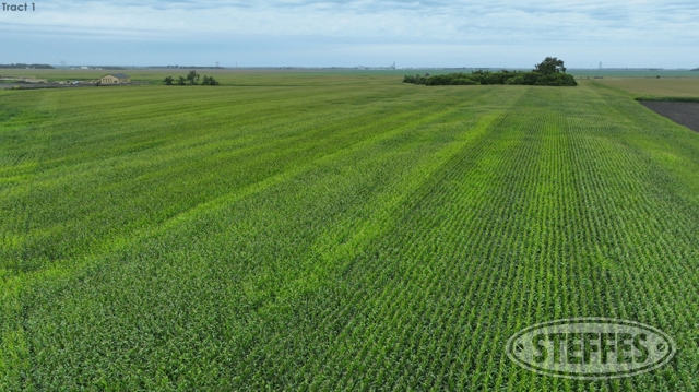
TRACT 1:
Description: E1/2W1/2 Less Tracts to Maple River Water District Section 36-139-52
Total Acres: 144.75+
Cropland Acres: 141.14+
PID #: 38-0000-04963-010
Soil Productivity Index: 81.9
Soils: Fargo silty clay (47.3%), Nutley silty clay (15%), Cashel silty clay (14.7%
Taxes (2023): $2,108.33
Please Note: Buyers should review the below information regarding the Buffalo-Lynchburg Channel drain improvement project.
The MRWRD obtained channel land in fee title along with a berm easement in June 2023. View Berm Easement Here.
There is a partially executed purchase agreement for access easements. View access easement Here.
View west access easement certificate of survey Here – access agreement to get from north end of parcel to south end of parcel on MRWRD land
View east access certificate of survey Here – access agreement to get to parcel from 157th Ave SE across MRWRD land
Channel Crossing Easement – the MRWRD agreed to construct a low water crossing and grant an easement for the landowner to maintain – Certificate of Survey not yet created and finalized
MRWRD has the land rights they need to construct the channel south but will need to work with the landowner to obtain land rights to construct the channel that branches off to the west – View preliminary construction plans Here.
TRACT 2:
Description: SW1/4 Less R/W & 10.11+ AC Surveyed Farmstead (Subject to Survey) Section 36-138-52
Total Acres: 147.81+ (Subject to Survey)
Cropland Acres: 144.8+
PID #: 52-0000-08861-000 (Includes T5 Farmstead)
Soil Productivity Index: 76.5
Soils: Fargo-Ryan, thick solum silty clays (29.9%), Kindred-Bearden silty clay loams (29.4%), Colvin silty clay loams (16.6%)
Taxes (2023): $2,705.07 (Includes T5 Farmstead)
TRACT 3:
Description: NW1/4 Less R/W Section 1-137-52
Total Acres: 160.31+
Cropland Acres: 155.6+
PID #: 51-0000-08402-000
Soil Productivity Index: 83.1
Soils: Fargo silty clay (27.6%), Fargo silty clay loam (23.5%), Kindred-Bearded silty clay loams (19.2)
Taxes (2023): $3,153.66
TRACT 4:
Description: SW1/4 Section 1-137-52
Total Acres: 160+
Cropland Acres: 155.6+
PID #: 51-0000-08403-000
Soil Productivity Index: 86.5
Soils: Kindred-Bearden silty clay loams (40.2%), Bearden-Kindred silty clay loams (20.9%), Fargo silty clay loam (19.5%)
Taxes (2023): $3,225.73
TRACT 5:
Description: 10.11+ Acre Surveyed Farmstead in SE1/4SW1/4 (Subject to Survey) Section 36-138-52
Address: 15647 48th St. SE, Davenport, ND 58021
Total Surveyed Acres: 10.11+ (Subject to Survey)
View Farmstead Survey Here
45’x28’ Home w/22’x12’ attached single stall garage: 3 Bedroom Rambler, 1 bath upstairs, ¾ bath in basement (needs to be enclosed), kitchen w/gas range, original hardwood floors, shingles updated in 2019, family room with fireplace (not used since 2000), GFA, Propane, Well Water (3 wells on site, 2 are functioning, one services house, the other services sprayers, etc.), Weathermaker Furnace replaced in 2023, Turbosoft water softener (installed 2007), Well-X-trol water tank (installed 1997), 500 gal. propane tank – leased – services range, furnace and water heater, electrical box upgraded in 2023, septic & drain tile updated 2020
118’x54’ Machine Shop: (2) 20’-6” wide x 11’-6” high sliding doors, (1)23’-6” wide x 13’-6” high sliding door.
PID #: 52-0000-08861-000 (Includes T2)
Taxes (2023): $2,705.07 (Includes T2)
Please Note: Cass County has budgeted paving the road adjacent to this farmstead next year.