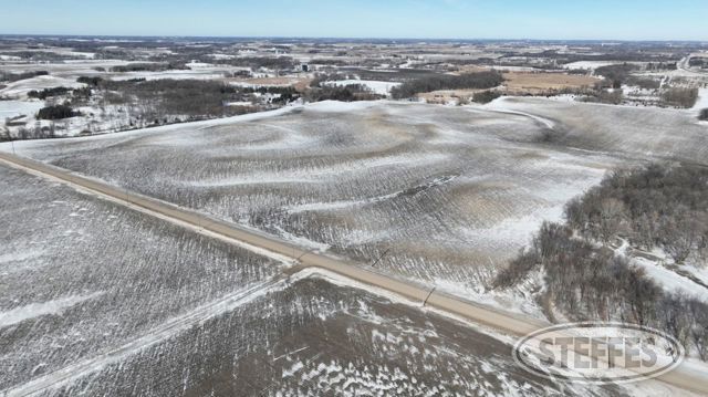
Wright County, MN – Stockholm Township
Total Acres: 183.34±
PID #: 218-000-221200, 218-000-222400, 218-000-221300, & 218-000-222100
To Be Sold in 2 Tracts!
TRACT 1:
Description: The Southeast Quarter of the Northwest Quarter (SE 1 /4 of the NW1 /4) and the Northeast Quarter of the Northwest Quarter (NE1/4 of the NW1/4), all in Section 22, Township 118 North, Range 28 West, Wright County, Minnesota. AND That part of the South Half of the Northeast Quarter (S1/2 of the NE1/4) and that part of the Northwest Quarter of the Northeast Quarter (NW1/4 of the NE1/4), all being in Section 22, Township 118 North, Range 28 West, Wright County, Minnesota, lying westerly of the following described line: Commencing at the East Quarter corner of said Section 22; thence on an assumed bearing of North 88 degrees 13 minutes 09 seconds West along the south line of said S1/2 of the NE1/4, 2459.00 feet to the west line of the tract described in Document No. 1074147, said point being the point of beginning of the line herein described; thence North 01 degrees 46 minutes 51 seconds East along the west line of said Document No. 1074147 and its northerly extension, 858.53 feet; thence North 43 degrees 26 minutes 01 seconds East, 227.52 feet; thence North 00 degrees 26 minutes 45 seconds East, 1215.61 feet to the southwest corner of the tract described in Document No. 1394471; thence North 12 degrees 07 minutes 45 seconds East along the west line of said Document No. 1394471, 459.50 feet to the north line of said NW1/4 of the NE1/4 and said line terminating thereat. EXCEPT (DOCUMENT NO. 1078724) DESCRIBED AS FOLLOWS: That part of the Northeast Quarter of the Northwest Quarter of Section 22, Township 118, Range 28, Wright County, Minnesota, described as follows: Begin at the Northwest corner of said Northeast Quarter of the Northwest Quarter; thence South 2° 01' 40" West (assumed bearing) along the West line thereof a distance of 487.1 o feet; thence North 88° 53' 40" East, 699. 77 feet; thence North 26° 44' 15" East, 181.75 feet; thence North 4° 59' 59" East, 324.14 feet to the North line of the said Northeast Quarter of the Northwest Quarter; thence South 89° 08' 14" West, along the North line thereof, 792.51 feet to the point of beginning.
ALSO EXCEPT (DOCUMENT NO. 1078724) DESCRIBED AS FOLLOWS: That part of the Northeast Quarter of the Northwest Quarter of Section 22, Township 118, Range 28, Wright County, Minnesota, described as follows: Commencing at the Northwest corner of said Northeast Quarter of the Northwest Quarter; thence South 2° 01' 40" West (assumed bearing) along the West line thereof a distance of 487.10 feet to the actual point of beginning; thence North 88° 53' 40" East, a distance of 124.05 feet; thence South 1 ° 07' 18" West a distance of 343.99 feet; thence North 89° 01' 20" West a distance of 142.78 feet to a point on the said West line distant 339.31 feet South of the point of beginning; thence North 2° 01' 40" East along the said West line a distance of 339.31 feet to the point of beginning.
Total Acres: 102.86± (See survey, Tract 1)
Cropland Acres: 93.97±
PID #: 218-000-221200 (That part of, new legal & PID# to be assigned), 218-000-222400, 218-000-221300 (That part of, new legal & PID# to be assigned), & 218-000-222100
Crop Productivity Index: 86
Soils: CokatoStorden complex, 6 to 12 percent slopes, eroded (30.2%), Hamel loam, 0 to 2 percent slopes (26.5%), CokatoStorden complex, 12 to 18 percent slopes, eroded (22.6%), ReedslakeLe Sueur complex, 1 to 6 percent slopes (10.2%), CanisteoGlencoe complex, 0 to 2 percent slopes (5.8%), Le Sueur loam, 1 to 3 percent slopes (3.8%), Klossner muck, 0 to 1 percent slopes (0.9%)
Taxes (2025): $4,098.00 (For entire land. New tax amount TBD)
NO US Fish & Wildlife Easement
TRACT 2:
Description: That part of the South Half of the Northeast Quarter (S1/2 of the NE1/4) and that part of the Northwest Quarter of the Northeast Quarter (NW1/4 of the NE1/4), all being in Section 22, Township 118 North, Range 28 West, Wright County, Minnesota, lying easterly of the following described line: Commencing at the East Quarter corner of said Section 22; thence on an assumed bearing of North 88 degrees 13 minutes 09 seconds West along the south line of said S1/2 of the NE1/4, 2459.00 feet to the west line of the tract described in Document No. 1074147, said point being the point of beginning of the line herein described; thence North 01 degrees 46 minutes 51 seconds East along the west line of said Document No. 1074147 and its northerly extension, 858.53 feet; thence North 43 degrees 26 minutes 01 seconds East, 227.52 feet; thence North 00 degrees 26 minutes 45 seconds East, 1215.61 feet to the southwest corner of the tract described in Document No. 1394471; thence North 12 degrees 07 minutes 45 seconds East along the west line of said Document No. 1394471, 459.50 feet to the north line of said NW1/4 of the NE1/4 and said line tenminating thereat. EXCEPT (DOCUMENT NO. 1394471) DESCRIBED AS FOLLOWS: That part of the Northwest Quarter of the Northeast Quarter of Section 22, Township 118, Range 28, described as follows: Commencing at the northwest corner of said Northeast Quarter; thence South 86 degrees 34 minutes 51 seconds East, assumed bearing, along the north line of said Northeast Quarter 368.00 feet to the point of beginning of the land to be described; thence continuing South 86 degrees 34 minutes 51 seconds East, along said north line 424.00 feet; thence South 05 degrees 15 minutes 00 seconds West 525.00 feet; thence North 78 degrees 10 minutes 00 seconds West 482.00 feet; thence North 12 degrees 07 minutes 45 seconds East 459.50 feet to the point of beginning. ALSO EXCEPT The South 290.00 feet of the East 37 4.00 feet of the Southeast Quarter of the Northeast Quarter (SE1/4 of the NE1/4) of Section 22, Township 118 North, Range 28 West, Wright County, Minnesota. ALSO EXCEPT (DOCUMENT NO. 1567317) DESCRIBED AS FOLLOWS: That part of the SE1/4 of the NE1/4 of Section 22, Township 118, Range 28, and that part of Parcel 31, WRIGHT COUNTY HIGHWAY RIGHT OF WAY PLAT NO. 67, described as follows: Beginning at the northeast corner of said SE1/4 of the NE1/4; thence westerly along the North line thereof to the point of intersection with the new centerline of County State Aid Highway No. 3 as shown on said WRIGHT COUNTY HIGHWAY RIGHT OF WAY PLAT NO. 67; thence southerly along said centerline to the point of intersection with the westerly extension of the North line of Parcel 28, said WRIGHT GOU NTY HIGHWAY RIGHT OF WAY PLAT NO. 67; thence easterly, along said westerly extension, to the East line of said SE1/4 of the NE1/4; thence northerly along said East line to said point of beginning. ALSO EXCEPT That part of the South Half of the Northeast Quarter (S1/2 of the NE1/4) of Section 22, Township 118 North, Range 28 West, Wright County, Minnesota, described as follows: Commencing at the East Quarter corner of said Section 22; thence on an assumed bearing of North 88 degrees 13 minutes 09 seconds West along the south line of said S1/2 of the NE1/4, 1767.79 feet to the point of beginning of the tract of land herein described; thence continue North 88 degrees 13 minutes 09 seconds west along last said line, 691.21 feet to the west line of the tract described in Document No. 1074147; thence North 01 degrees 46 minutes 51 seconds East along the west line of said Document No. 1074147 and its northerly extension, 858.53 feet; thence North 43 degrees 26 minutes 01 seconds East, 227.52 feet; thence South 78 degrees 26 minutes 34 seconds East, 510.43 feet; thence South 00 degrees 28 minutes 02 seconds East, 942.59 feet to the point of beginning and there terminating.
Total Acres: 80.48± (See survey, Tract 2)
Cropland Acres: 76.01±
PID #: 218-000-221200 (That part of, new legal & PID# to be assigned) & 218-000-221300 (That part of, new legal & PID# to be assigned)
Crop Productivity Index: 90.2
Soils: CanisteoGlencoe complex, 0 to 2 percent slopes (33.0%), ReedslakeLe Sueur complex, 1 to 6 percent slopes (29.5%), CokatoStorden complex, 6 to 12 percent slopes, eroded (23.8%), Klossner muck, 0 to 1 percent slopes (6.5%), Glencoe clay loam, 0 to 1 percent slopes (4.2%), Cordova clay loam, 0 to 2 percent slopes (1.8%), Hamel loam, 0 to 2 percent slopes (1.2%)
Taxes (2025): $2,276.00 (For entire land. New tax amount TBD)
NO US Fish & Wildlife Easement
TERMS: Ten percent down upon signing purchase agreement, payable by cash or check. Balance due at closing within 30 days. This is a 5% buyer’s premium auction.
CONTACT