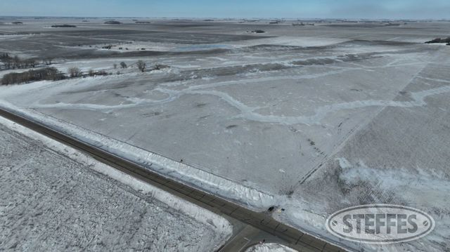
Grant County, MN – Logan Township
Total Acres: 375.63±
PID #: 09-0039-100, 09-0057-000, 09-0057-300
To Be Sold in 3 Tracts!
TRACT 1:
Description: The West Half (W1/2) of the Southwest Quarter (SW1/4) AND all that part of the North Half (N1/2) lying South and West of the right-of-way of the Great Northern Railway all being in Section Eleven (11) Township One Hundred Twenty-seven (127) North Range Fourty-four (44) West; EXCEPT: That part of the West Half of the Southwest Quarter (YV1/2 SW1/4) of Section 11, Township 127 North, Range 44 West, Grant County, Minnesota, described as follows: Beginning at the southwest comer of said Section 11: thence North 00 degrees 22 minutes 27 seconds West, assumed bearing along the west line of said Section 11, a distance of 159. 79 feet; thence North 88 degrees 12 minutes 24 seconds East 312.26 feet; thence North 00 degrees 22 minutes 27 seconds West 330.00 feet; thence North 57 degrees 29 minutes 05 seconds East 123.08 feet; thence North 00 degrees 56 minutes 43 seconds East 293.16 feet; thence North 51 degrees 55 minutes 19 seconds East 512.34 feet; thence North 33 degrees 23 minutes 39 seconds East 888.50 feet to the east line of aforesaid West Half of the Southwest Quarter (YV1/2 SW1/4); thence South 00 degrees 20 minutes 23 seconds East, along said east line of the West Half of the Southwest Quarter (YV1/2 SW1/4), a distance of 1923.06 feet to the south line of said Section 11; thence North 89 degrees 43 minutes 21 seconds West, along said south line of Section 11, a distance of 1321.28 feet to the point of beginning.
Total Acres: 195.84± (See survey, Tract C)
Cropland Acres: 162.07±
PID #: 09-0039-100
Crop Productivity Index: 87.4
Soils: Roliss loam, 0 to 2 percent slopes (77.4%), Towner fine sandy loam, 0 to 3 percent slopes (12.6%), RolissVallers loams, 0 to 1 percent slopes (9.3%), SandbergRadium complex, 0 to 6 percent slopes (0.7%)
NO US Fish & Wildlife Easement
TRACT 2:
Description: That part of the Northeast Quarter (NE1/4) of Section 15, Township 127 North, Range 44 West, Grant County, Minnesota, described as follows: Commencing at the Northeast corner of said Section 15; thence on an assumed bearing of South 89 degrees 56 minutes 38 seconds West along the north line of said Section 15, 213.41 feet to the point of beginning of the tract of land herein described; thence South 00 degrees 28 minutes 20 seconds East, 365.00 feet; thence South 28 degrees 10 minutes 28 seconds West, 127.00 feet; thence South 01 degrees 32 minutes 50 seconds West, 44.00 feet; thence South 29 degrees 06 minutes 20 seconds West, 168.43 feet to the westerly extension of the south line of the North 670.00 feet of the Northwest Quarter (NW1/4) of Section 14, Township 127 North, Range 44 West; thence South 29 degrees 06 minutes 18 seconds West, 1315.00 feet; thence North 90 degrees 00 minutes 00 seconds West, 1635.00 feet to the west line of said NE1/4, said point being distant 3483.80 feet northerly of the South Quarter corner of said Section 15 as measured along the west line of the East Half of said Section 15; thence North 00 degrees 18 minutes 34 seconds West along the west line of said NE1 /4, 1814.67 feet to the North Quarter corner of said Section 15; thence North 89 degrees 56 minutes 38 seconds East along the north line of Section 15, 2424.50 feet to the point of beginning and there terminating.
Total Acres: 88.28± (See Survey, Tract B)
Cropland Acres: 86.78±
PID #: 09-0057-000
Crop Productivity Index: 90.7
Soils: RolissVallers loams, 0 to 1 percent slopes (62.4%), Roliss loam, 0 to 2 percent slopes (25.5%), RockwellVallers complex, 0 to 1 percent slopes (11.7%), SandbergRadium complex, 0 to 6 percent slopes (0.4%)
NO US Fish & Wildlife Easement
TRACT 3:
Description: That part of the East Half (E1/2) of Section 15, Township 127 North, Range 44 West, Grant County, Minnesota, described as follows: Beginning at the Southeast corner of said Section 15; thence on an assumed bearing of North 89 degrees 48 minutes 32 seconds West along the south line of said E1/2 of Section 15, 1650.00 feet; thence North 18 degrees 11 minutes 28 seconds East, 1204.50 feet; thence North 89 degrees 48 minutes 32 seconds West, 17.96 feet; thence North 19 degrees 03 minutes 05 seconds East, 3692.42 feet to the westerly extension of the south line of the North 670.00 feet of the Northwest Quarter (NW1/4) of Section 14, Township 127 North, Range 44 West; thence South 89 degrees 43 minutes 21 seconds East along last said line, 45.80 feet to the east line of said Section 15; thence South 00 degrees 28 minutes 20 seconds East along last said line, 1994.80 feat to the East Quarter corner of said Section 15; thence South 00 degrees 31 minutes 48 seconds East along the east line of said Section 15, 2645.22 feat to the point of beginning and there terminating.
Total Acres: 91.51± (See survey, Tract A)
Cropland Acres: 91.51±
PID #: 09-0057-300
Crop Productivity Index: 88.7
Soils: FlomAazdahlHamerly complex, 0 to 2 percent slopes (91.9%), AazdahlBalaton clay loams, 0 to 2 percent slopes (8.1%)
NO US Fish & Wildlife Easement