OPENS: TUESDAY, SEPTEMBER 5
Goodhue County, MN– Minneola Township
Description: NE1/4 OF SE1/4 & S534FT BEING 32.36AC REC
S1/2 OF SE1/4 SEC 27-110-16 EX 4/16/90 EX 11.12AC
Sect-27 Twp-110 Range-016
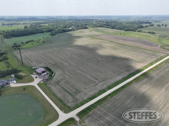
Total Acres: 75.74±
PID #: 38-027-0600
To Be Sold in 2 Tracts!
TRACT 1:
Description: Parcel 7a (on Survey) The Northeast Quarter (NE ¼) of the Southeast Quarter (SE ¼) in Section 27, Township 110 North, Range 16 West.
Total Acres: 39.7± (see survey on bottom of information page)
Cropland Acres: See FSA Map on bottom of Information Page
PID #: 38-027-0600 (That part of, new legal & PID# to be assigned)
Soil Productivity Index: 95.1
Soils: Kasson silt loam (59.5%), Klinger silt loam (33.1%), Maxfield silt loam (7.2%), Maxfield silty clay loam (0.2%)
Taxes (2023): $2,932 (For entire land. New tax amount TBD)
TRACT 2:
Description: Parcel 7b (on Survey)
The South Half (S 1/2) of the Southeast Quarter (SE 1/4) in Section 27, Township 110 North, Range 16 West.
Except: The South 534 feet of the Southeast Quarter (SE 1/4) of Section 27, Township 110 North, Range 16 West
Further excepting therefrom: That part of the Southeast Quarter of the Southeast Quarter of Section 27, Township 110, Range 16 West, Goodhue County, Minnesota, described as follows:
Beginning at the northeast corner of said Southeast Quarter of the Southeast Quarter; thence South 0 degrees 42 minutes 15 seconds East (HARN adjustment of the 1983 Goodhue County Coordinate System) along the east line of said Southeast Quarter of the Southeast Quarter 782.35 feet to the north line of the South 534.00 feet of said Southeast Quarter of the Southeast Quarter; thence North 89 degrees 44 minutes 16 seconds West along said north line 1132.15 feet; thence North 52 degrees 34 minutes 20 seconds East 1279.50 feet to the north line of said Southeast Quarter of the Southwest Quarter; thence South 89 degrees 43 minutes 27 seconds East along said north line 106.45 feet to the point of beginning.
Total Acres: 36.04± (see survey on bottom of information page)
Cropland Acres: See FSA Map on bottom of Information Page
PID #: 38-027-0600 (That part of, new legal & PID# to be assigned)
Soil Productivity Index: 84.1
Soils: Bassett-Kasson complex (34.2%), Maxfield silt loam (22.0%), Klinger silt loam (20.7%), Kasson silt loam (18.3%), Meridian-Bassett complex (2.9%), Maxfield silty clay loam (2.0%)
Taxes (2023): $2,932 (For entire land. New tax amount TBD)