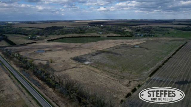
Traverse County, MN – Folsom Township
Description: The Southwest Quarter (SW1/4) of Section Twenty-eight (28), in Township One Hundred Twenty-five (125) North, of Range Forty-nine (49) West of the Fifth Principal Meridian, excepting therefrom the West 120 Feet of the Southwest Quarter of the Southwest Quarter (SW1/4-SW1/4) of said Section 28, and excepting also that portion of the Northwest Quarter of the Southwest Quarter (NW1/4-SW1/4) of said Section 28 lying West of a line described as follows: Beginning at a point on the North line of said NW1/4-SW1/4, 170.0 Feet East of the Northwest corner thereof; thence South 15 Degrees 58 Minutes East 310.0 Feet; thence South 3 Degrees 45 Minutes East, 643.4 Feet; thence South 31 Degrees 40 Minutes West, 346.6 Feet; thence South 14 Degrees 25 Minutes West, 90.3 Feet, more or less, to a point on the South line of said NW1/4-SW1/4, 120.0 Feet East of the Southwest corner thereof, also excepting therefrom the tract of land described by metes and bounds as follows, to-wit: Commencing at a point along the East line of the SW1/4 of Section 28, Township 125, Range 49 a distance of 86 Rods South of the Northeast corner of said SW1/4 (said point being the point of beginning); thence North along the East line of said SW1/4 a distance of 86 Rods to the Northeast corner of said SW1/4; thence West along the North line of said SW1/4 a distance of 86 Rods; thence Southeasterly in a straight line to the point of beginning. ALSO EXCEPT The South 807.00 feet of the Southwest Quarter (SW1/4) of Section 28, Township 125 North, Range 49 West, Traverse County, Minnesota, lying easterly of the West 120.00 feet of the Southwest Quarter of the Southwest Quarter (SW1/4 of the SW1/4) of said Section 28. ALSO EXCEPT That part of the Southwest Quarter (SW1/4) of Section 28, Township 125 North, Range 49 West, Traverse County, Minnesota, described as follows: Commencing at the northeast corner of said SW1/4; thence on an assumed bearing of South 00 degrees 13 minutes 46 seconds West along the east line of said SW1/4, 1419.00 feet (86 rods); thence North 44 degrees 43 minutes 33 seconds West, 2008.34 feet to a point on the north line of said SW1/4 distant 1419.00 feet (86 rods) west of the northeast corner of said SW1/4, said point being the point of beginning of the tract herein described; thence return South 44 degrees 43 minutes 33 seconds East, 1263.87 feet; thence South 28 degrees 05 minutes 53 seconds West, 46.71 feet; thence North 47 degrees 55 minutes 31 seconds West, 1402.97 feet to the north line of said SW1/4; thence South 89 degrees 40 minutes 52 seconds East along last said line, 173.99 feet to the point of beginning.
Total Acres: 77.08± (See survey, Tract 1)
PID #: 05-0149000 (That part of, new legal & PID# to be assigned)
Taxes (2026): $1,046.00 (For entire land. New tax amount TBD)
Has Perpetual Rim Conservation Easement
Has a flowage easement to U.S. Army Corps Engineering Lands.
TERMS: Ten percent down upon signing purchase agreement, payable by cash or check. Balance due at closing within 30 days. This is a 5% buyer’s fee auction.