AUCTION INFORMATION
BIG STONE COUNTY, MN – BROWNS VALLEY TOWNSHIP
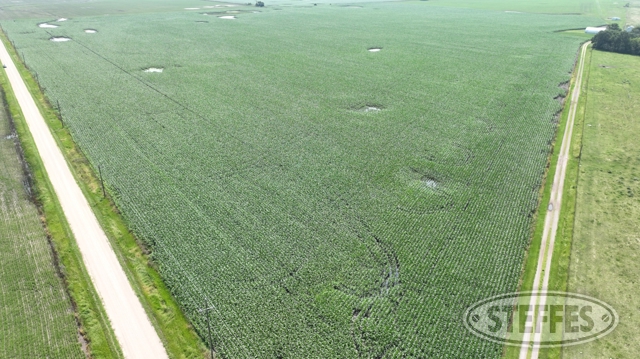
Total Acres: 703.83±
PID #: 05-0013-000, 05-0009-000, 05-0014-011, 05-0015-000, & 05-0025-000
To Be Sold in 8 Tracts!
TRACT 1:
Description: Government Lot 1 and Government Lot 2 of Section 2, Township 124 North, Range 49 West, Big Stone, County, Minnesota.
Total Acres: 89.40± (See Survey, Tract A)
Cropland Acres: 86.37±
PID #: 05-0009-000 (That part of, new legal & PID# to be assigned)
Soil Productivity Index: 95.7
Soils: Doran clay loam (75.8%), FlomHamerly complex, 0 to 2 percent slopes (16.0%), AazdahlBalatonFlom complex, 0 to 3 percent slopes (3.1%), Lindaas silty clay loam (2.6%), Spottswood loam (1.7%), Doran clay loam (0.5%), Lindaas clay loam (0.2%), AazdahlBalatonFlom complex, 0 to 3 percent slopes (0.1%)
Taxes (2024): $5,342.00 (For entire land. New tax amount TBD)
TRACT 2:
Description: Government Lot 3 and Government Lot 4 of Section 2, Township 124 North, Range 49 West, Big Stone, County, Minnesota.
Total Acres: 90.22± (See Survey, Tract B)
Cropland Acres: 86.38±
PID #: 05-0009-000 (That part of, new legal & PID# to be assigned)
Soil Productivity Index: 87.6
Soils: Embden loam (44.3%), Doran clay loam (29.5%), Spottswood loam (11.8%), Fordville loam, 0 to 2 percent slopes (5.2%), Sverdrup sandy loam, 2 to 6 percent slopes (4.4%), FlomHamerly complex, 0 to 2 percent slopes (3.9%), Doran clay loam (0.6%), Clontarf sandy loam (0.3%)
Taxes (2024): $5,342.00 (For entire land. New tax amount TBD)
TRACT 3:
Description: Government Lot 1 and Government Lot 2 of Section 3, Township 124 North, Range 49 West, Big Stone, County, Minnesota
Total Acres: 89.90± (See Survey, Tract C)
Cropland Acres: 86.49±
PID #: 05-0013-000 (That part of, new legal & PID# to be assigned)
Soil Productivity Index: 87.3
Soils: Embden loam (70.8%), Spottswood loam (15.3%), Egeland sandy loam, 0 to 2 percent slopes (7.6%), Swenoda sandy loam, 0 to 2 percent slopes (5.6%), Clontarf sandy loam (0.4%), Doran silty clay loam, loamy substratum (0.2%), Doran clay loam (0.1%)
Taxes (2024): $4,768.00 (For entire land. New tax amount TBD)
TRACT 4:
Description: The North Half of the Northeast Quarter and the North Half of the Northwest Quarter, Section 10, Township 124 North, Range 49 est, Except all that part and portion of the North Half of the Northeast Quarter and the North Half of the Northwest Quarter of Section 10, Township 124, Range 49, lying West of State Highway 28; AND Further Except Lot A of the Northeast Quarter of the Northwest Quarter, Section 10, Township 124 North, Range 49 West of the Fifth Principal Meridian, according to the Auditor’s Plat on file with the Register of Deeds (now County Recorder), Big Stone County, Minnesota, in Book 4 of Plats on Page 178.
Total Acres: 97.35± (See Survey, Tract H)
Cropland Acres: 85±
PID #: 05-0025-000
Soil Productivity Index: 94.8
Soils: Swenoda sandy loam, 0 to 2 percent slopes (70.8%), Embden loam (20.2%), AazdahlBalaton clay loams, 0 to 2 percent slopes (9.0%)
Taxes (2024): $2,648.00
TRACT 5:
Description: Government Lot 3 and that part of Government Lot 4, all being in Section 3, Township 124 North, Range 49 West, Big Stone County, Minnesota, lying easterly of the following described line: Commencing at the Northwest corner of said Section 3; thence on an assumed bearing of South 89 degrees 13 minutes 11 seconds East along the north line of said Government Lot 4, a distance of 35.15 feet to the point of beginning of the line herein described; thence South 07 degrees 56 minutes 14 seconds East, a distance of 57.47 feet; thence South 24 degrees 34 minutes 29 seconds East, a distance of 1411.98 feet to the north line of Lot A of Government Lot 4 and the Northwest Quarter of the Southwest Quarter of Section 3, and Government Lot 1 and the Northeast Quarter of the Southeast Quarter of Section 4, Township 124 North, Range 49 West, Big Stone County, Minnesota, according to the recorded plat thereof, and said line terminating thereat. EXCEPT Lot A of Government Lot 4 and the Northwest Quarter of the Southwest Quarter of Section 3, and Government Lot 1 and the Northeast Quarter of the Southeast Quarter of Section 4, Township 124 North, Range 49 West, Big Stone County, Minnesota, according to the recorded plat thereof
Total Acres: 77.29± (See Survey, Tract D/Lot E)
Cropland Acres: 77.29±
PID #: 05-0013-000 (That part of, new legal & PID# to be assigned)
Soil Productivity Index: 87.7
Soils: AazdahlBalaton clay loams, 0 to 2 percent slopes (60.7%), Spottswood loam (23.2%), Swenoda sandy loam, 2 to 6 percent slopes (7.6%), Doran clay loam (6.7%), Egeland sandy loam, 0 to 2 percent slopes (1.6%), DoranLindaas silty clay loams (0.2%)
Taxes (2024): $7,554.00 (For entire land. New tax amount TBD)
TRACT 6:
Description: That part of the Southwest Quarter (SW1/4) of Section 3, Township 124 North, Range 49 West, Big Stone County, Minnesota, lying easterly of the easterly right of way line of the Burlington Northern Railroad and lying westerly and southerly of the following described line: Commencing at the South Quarter corner of said Section 3; thence on an assumed bearing of South 89 degrees 50 minutes 22 seconds West along the south line of said SW1/4, a distance of 723.64 feet to the point of beginning of the line herein described; thence North 25 degrees 31 minutes 44 seconds West, a distance of 2285.59 feet to the southeast corner of Lot A of Government Lot 4 and the Northwest Quarter of the Southwest Quarter of Section 3, and Government Lot 1 and the Northeast Quarter of the Southeast Quarter of Section 4, Township 124 North, Range 49 West, Big Stone County, Minnesota, according to the recorded plat thereof; thence North 89 degrees 05 minutes 51 seconds West along the south line of said Lot A, a distance of 7 46. 7 4 feet to the easterly right of way line of said Burlington Northern Railroad and said line terminating thereat.
AND
That part of Government Lot 1 of Section 4, Township 124 North, Range 49 West, Big Stone County, Minnesota, lying easterly of the easterly right of way line of the Burlington Northern Railroad. AND That part of Government Lot 4 of Section 3, Township 124 North, Range 49 West, Big Stone County, Minnesota, lying westerly of the following described line: Commencing at the Northwest corner of said Section 3; thence on an assumed bearing of South 89 degrees 13 minutes 11 seconds East along the north line of said Government Lot 4, a distance of 35.15 feet to the point of beginning of the line herein described; thence South 07 degrees 56 minutes 14 seconds East, a distance of 57.47 feet; thence South 24 degrees 34 minutes 29 seconds East, a distance of 1411.98 feet to the north line of Lot A of Government Lot 4 and the Northwest Quarter of the Southwest Quarter of Section 3, and Government Lot 1 and the Northeast Quarter of the Southeast Quarter of Section 4, Township 124 North, Range 49 West, Big Stone County, Minnesota, according to the recorded plat thereof, and said line terminating thereat. EXCEPT Lot A of Government Lot 4 and the Northwest Quarter of the Southwest Quarter of Section 3, and Government Lot 1 and the Northeast Quarter of the Southeast Quarter of Section 4, Township 124 North, Range 49 West, Big Stone County, Minnesota, according to the recorded plat thereof ALSO EXCEPT That part of Government Lot 1 of Section 4, Township 124 North, Range 49 West, Big Stone County, Minnesota, described as follows: Commencing at the Northeast corner of said Section 4; thence on an assumed bearing of North 89 degrees 35 minutes 36 seconds West along the north line of said Government Lot 1, a distance of 106.90 feet; thence South 01 degree 44 minutes 03 seconds East, a distance of 27.48 feet to the point of beginning of the tract of land herein described; thence continue South 01 degree 44 minutes 03 seconds East, a distance of 112.27 feet; thence South 88 degrees 47 minutes 24 seconds East, a distance of 91.66 feet; thence North 02 degrees 11 minutes 19 seconds West, a distance of 113.25 feet; thence North 89 degrees 22 minutes 32 seconds West, a distance of 90.72 feet to the point of beginning and there terminating.
Total Acres: 61.17± (See Survey, Tract E/Lot C & F)
PID #: 05-0015-000 (That part of, new legal & PID# to be assigned), 05-0013-000 (That part of, new legal & PID# to be assigned) & 05-0014-011 (That part of, new legal & PID# to be assigned)
Soil Productivity Index: 66.1
Soils: LangheiBarnesDarnen complex, 5 to 30 percent slopes (43.2%), Darnen loam, 1 to 6 percent slopes (32.5%), Swenoda sandy loam, 0 to 2 percent slopes (24.3%)
Taxes (2024): $8,162.00 (For entire land. New tax amount TBD)
TRACT 7:
Description: That part of Government Lot 1 of Section 4, Township 124 North, Range 49 West, Big Stone County, Minnesota, lying westerly of the centerline of Minnesota Trunk Highway No. 28. AND That part of the East Half of the Southeast Quarter (E1/2 of the SE1/4) of Section 4, Township 124 North, Range 49 West, Big Stone County, Minnesota, lying westerly of the centerline of Minnesota Trunk Highway No. 28. AND That part of the Southwest Quarter (SW1/4) of Section 3, Township 124 North, Range 49 West, Big Stone County, Minnesota, lying westerly of the centerline of Minnesota Trunk Highway No. 28.
Total Acres: 118.31± (See Survey, Tract F/Lot B)
PID #: 05-0015-000 (That part of, new legal & PID# to be assigned) & 05-0014-011 (That part of, new legal & PID# to be assigned)
Soil Productivity Index: 60
Soils: LangheiBarnesDarnen complex, 5 to 30 percent slopes (39.1%), Lamoure silty clay loam, 0 to 2 percent slopes, occasionally flooded (23.5%), HokansSvea complex, 2 to 9 percent slopes (19.3%), La Prairie loam, 0 to 2 percent slopes, occasionally flooded (13.4%), Marysland loam, 0 to 2 Apercent slopes (4.5%), Darnen loam, 1 to 6 percent slopes (0.2%)
Taxes (2024): $3,394.00 (For entire land. New tax amount TBD)
TRACT 8:
Description: That part of the Southwest Quarter (SW1/4) of Section 3, Township 124 North, Range 49 West, Big Stone County, Minnesota, lying easterly of the following described line: Commencing at the South Quarter corner of said Section 3; thence on an assumed bearing of South 89 degrees 50 minutes 22 seconds West along the south line of said SW1/4, a distance of 723.64 feet to the point of beginning of the line herein described; thence North 25 degrees 31 minutes 44 seconds West, a distance of 2285.59 feet to the southeast corner of Lot A of Government Lot 4 and the Northwest Quarter of the Southwest Quarter of Section 3, and Government Lot 1 and the Northeast Quarter of the Southeast Quarter of Section 4, Township 124 North, Range 49 West, Big Stone County, Minnesota, according to the recorded plat thereof; thence North 00 degrees 54 minutes 09 seconds East along the east line of said Lot A, a distance of 568.77 feet to the north line of said SW1/4 and said line terminating thereat.
Total Acres: 80.19± (See Survey, Tract G/Lot D)
PID #: 05-0015-000 (That part of, new legal & PID# to be assigned) & 05-0014-011 (That part of, new legal & PID# to be assigned)
Soil Productivity Index: 88.5
Soils: Swenoda sandy loam, 0 to 2 percent slopes (46.9%), Egeland sandy loam, 0 to 2 percent slopes (25.5%), Swenoda sandy loam, 2 to 6 percent slopes (20.0%), Embden loam (3.2%), Spottswood loam (2.5%), AazdahlBalaton clay loams, 0 to 2 percent slopes (1.9%)
Taxes (2024): $3,394.00 (For entire land. New tax amount TBD)
Contains ingress/egress easement: A 33.00 foot wide easement for ingress and egress purposes over and across that part of Northeast Quarter of the Northwest Quarter (NE1/4 of the NW1/4) of Section 10 and that part of the Southwest Quarter (SW1 /4) of Section 3 and that part of Lot A of the NE1/4 of the NW1/4 of Section 10, Township 124 North, Range 49 West, Big Stone County, Minnesota. The centerline of said easement is described as follows: Commencing at the South Quarter corner of said Section 3; thence North 87 degrees 23 minutes 21 seconds West, a distance of 615.25 feet to the point of beginning of the centerline herein described, it is assumed that the south line of said SW1/4 bears South 89 degrees 50 minutes 22 seconds West; thence South 78 degrees 51 minutes 07 seconds West, a distance of 540.00 feet; thence South 64 degrees 42 minutes 36 seconds West, a distance of 200.62 feet to the easterly right of way line of Minnesota Trunk Highway No. 28 and said centerline terminating thereat. The sidelines of said easement shall be shortened or prolonged to said easterly right of way line.
TERMS: Ten percent down upon signing purchase agreement, payable by cash or check. Balance due at closing within 30 days. This is a 5% buyer’s premium auction.
CONTACT
Scott Gillespie at Steffes Group (320) 760-3066 or Ashley Huhn at Steffes Group (701) 238-1975 or (320) 693-9371
Steffes Group, Inc, 23579 MN Hwy 22 South, Litchfield, MN 55355